IGCP Project 559
Crustal Architecture and Images

contact us: [email protected] | about us
|
IGCP Project 559
Crustal Architecture and Images |
|
|
contact us: [email protected] | about us
|
34th International
|
Updated: IGCP Project 559 - Seismic ImagesAgulhas-Karoo Geoscience Transect, South AfricaSouthern Africa and its southern continental margin offer an unrivalled region, where continental accretation processes over a period of more than 3.5 billion years can be studied. Along a geoscientific transect from the Agulhas Plateau across the Agulhas-Falkland fracture zone, the Outeniqua Basin , the Cape Fold Belt, the Namaqua-Natal Belt into the Karoo Province , geophysical and geological data and samples have been collected in 2004 and 2005. These data are currently being used to build a model of the evolution and crustal accretation as well as the continental break-up of this region. The Agulhas-Karoo Geoscience Transect is part of the South African - German cooperative research project “Inkaba ye Africa ”, which aims to investi ga te South Africa in a cone-shaped sector from core to space. A combined land-sea deep crustal seismic reflection and refraction survey as well as a magneto-telluric survey provide detailed structures and constraints for physical parameters from the sediments to the upper mantle which will be integrated with geological, petrological and geochemical analysis on rock composition, age and alteration history to form an overarching geodynamic model of the evolution of this region and its sedimentary, tectonic and magmatic units. 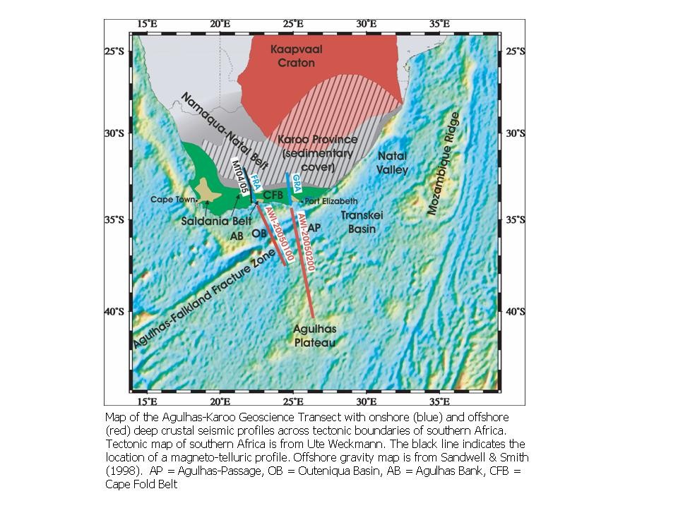
The transect addresses the following important questions:
Coordinators: Karsten Gohl , Alfred Wegener Institute for Polar and Marine Research (AWI), [email protected] |
| Disclaimer | Copyright | |